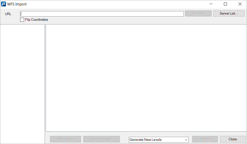
(Technology Preview) OGC WFS Service - WFS Import Dialog
Used to create a connection to a Web Feature Service (WFS), a standard from the Open Geospatial Consortium (OGC). You can also import features using this dialog.
You can access this dialog from the following.
| Setting | Description |
|---|---|
| URL | Use to specify URL of the WFS server to access. You can manually enter the URL or use the Server List button to select a saved server address. |
| Connect | Use to create the connection to the specified server. |
| Server List | Use to add, remove, or select frequently used servers. |
| Flip Co-ordinate |
Avoids queried features being rotated or flipped. |
| Add Layers | Use to add the layers of this connection in your active layers list present in the right panel. Activates when you click on connect to the selected URL. |
| Remove Layers | Use to remove one of the active layers. You can select the desired layer to remove in the right panel and click Remove Layer button. |
| Level Manager | Use to generate one new level per imported layer.
OR Use to add all the imported instances of all the layers to the active level. |
| Import | Imports all the instances of all the active layers that overlap the extent of the active view. |
| Close | Closes the connection to the server and the WFS Import dialog. |